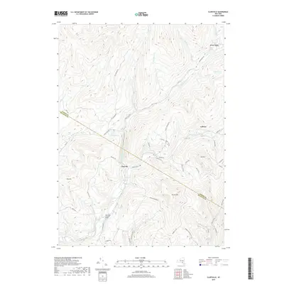
2019 Map of Claryville
USGS Topo · Published 2019About this map
The Halls Mills Covered Bridge anchors the southern portion of this landscape, where the Neversink River begins its journey through the Catskills. This 2019 survey captures the convergence of the West Branch Neversink River and the East Branch Neversink River at the hamlet of Claryville. The terrain is defined by high peaks such as Blue Hill and Denman Mtn, which separate narrow valleys where settlements like Ladleton and Frost Valley are situated along winding mountain roads. A complex network of drainage basins is visible, including Willowemoc Cr in the west and Sugarloaf Brook in the southeast. These waterways and the historic road network, including Co Rd 47 and Peekamose Hollow Rd, illustrate the long-standing geographic isolation and specialized mountain economy of the Ulster and Sullivan county border region.
Find a feature on this map
53 named features on this map. Tap any name to fly to it.
Don’t see what you’re looking for? This feature index may not catch every label — zoom into the map to look around manually.
Map Details
Editions of this 2019 Claryville Map
This is the sole edition of this map. No revisions or reprints were ever made.
Other maps of this area

1900 · Phoenicia
USGS Topo · 1:62,500

1901 · Margaretville
USGS Topo · 1:62,500

1903 · Phoenicia
USGS Topo · 1:62,500

1903 · Slide Mountain
USGS Topo · 1:62,500

1904 · Margaretville
USGS Topo · 1:62,500

1905 · Slide Mountain
USGS Topo · 1:62,500

1910 · Neversink
USGS Topo · 1:62,500

1942 · Neversink
USGS Topo · 1:62,500

1942 · Lackawack
USGS Topo · 1:24,000

1943 · Peekamoose Mountain
USGS Topo · 1:31,680