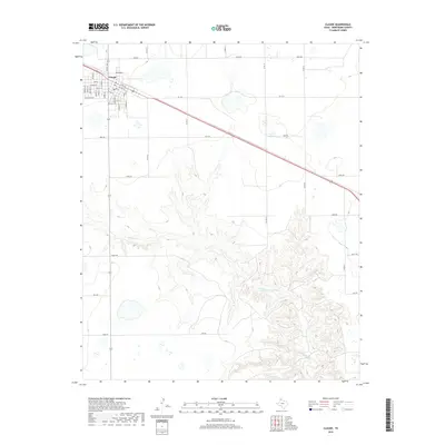
2019 Map of Claude
USGS Topo · Published 2019About this map
Claude serves as the primary hub of this High Plains landscape, where the town’s grid is defined by streets such as Goodnight St, Hoffer St, and Campbell St. The community sits at a significant transport junction, with Ranch Rd 1151 and Fm 1151 cutting through the agricultural tableland. South of the town, the terrain shifts dramatically as the headwaters of Mulberry Cr begin to carve deep into the plateau, creating a network of drainage patterns that stand in stark contrast to the flat farmlands above.
Find a feature on this map
36 named features on this map. Tap any name to fly to it.
Don’t see what you’re looking for? This feature index may not catch every label — zoom into the map to look around manually.
Map Details
Editions of this 2019 Claude Map
This is the sole edition of this map. No revisions or reprints were ever made.
Other maps of this area

1954 · Amarillo
USGS Topo · 1:250,000

1954 · Plainview
USGS Topo · 1:250,000

1958 · Amarillo
USGS Topo · 1:250,000

1958 · Plainview
USGS Topo · 1:250,000

1960 · Claude
USGS Topo · 1:62,500

1960 · Groom
USGS Topo · 1:62,500

1963 · Blue Hole Springs
USGS Topo · 1:24,000

1963 · Luttrell Springs
USGS Topo · 1:24,000

1963 · Luttrell Springs NE
USGS Topo · 1:24,000
1983 · Lark
USGS Topo · 1:24,000