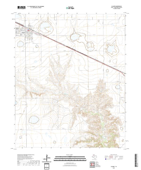
2022 Map of Claude
USGS Topo · Published 2022About this map
Claude serves as the focal point of this high-plains landscape, clearly showing the structured street grid of the county seat. At the center of the community, the Armstrong County Courthouse stands as a landmark of civic life, surrounded by a network of residential and commercial streets including Orient St, Church St, and Goodnight St. The urban layout is defined by its proximity to major transportation routes, while the outskirts quickly transition into the open ranching territory of the Texas Panhandle.
Find a feature on this map
42 named features on this map. Tap any name to fly to it.
Don’t see what you’re looking for? This feature index may not catch every label — zoom into the map to look around manually.
Map Details
Editions of this 2022 Claude Map
This is the sole edition of this map. No revisions or reprints were ever made.
Other maps of this area

1954 · Amarillo
USGS Topo · 1:250,000

1954 · Plainview
USGS Topo · 1:250,000

1958 · Amarillo
USGS Topo · 1:250,000

1958 · Plainview
USGS Topo · 1:250,000

1960 · Claude
USGS Topo · 1:62,500

1960 · Groom
USGS Topo · 1:62,500

1963 · Blue Hole Springs
USGS Topo · 1:24,000

1963 · Luttrell Springs
USGS Topo · 1:24,000

1963 · Luttrell Springs NE
USGS Topo · 1:24,000
1983 · Lark
USGS Topo · 1:24,000