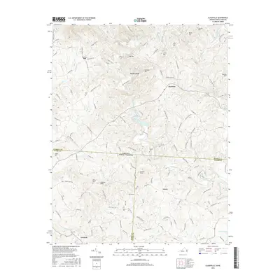
2016 Map of Claudville
USGS Topo · Published 2016About this map
The Ararat River and Dan River carve through the complex terrain of the Virginia-North Carolina border, anchoring a landscape defined by high ridges and small agricultural communities. This area, spanning Patrick County in Virginia and Surry and Stokes Counties in North Carolina, is marked by prominent elevations such as Mill Mtn, Simmons Mtn, and Chestnut Ridge. The map documents the localized settlement patterns of Claudville, Asbury, and Woodville, where family and community history is anchored by numerous small burial grounds like Unity Cem, Hatcher Cem, and Mount Herman Cem. The presence of Carters Mill and the convergence of several waterways, including the Little Dan River and Squirrel Cr, illustrate how the drainage network historically dictated the placement of industry and roads. The rugged topography is further highlighted by distinct landmarks such as Archies Knob and Nunns Mtn, showing the persistent rural character of this Piedmont borderland.
Find a feature on this map
126 named features on this map. Tap any name to fly to it.
Don’t see what you’re looking for? This feature index may not catch every label — zoom into the map to look around manually.
Map Details
Editions of this 2016 Claudville Map
This is the sole edition of this map. No revisions or reprints were ever made.
Other maps of this area

1889 · Hillsville
USGS Topo · 1:125,000

1891 · Yadkinville
USGS Topo · 1:125,000

1892 · Hillsville
USGS Topo · 1:125,000

1893 · Yadkinville
USGS Topo · 1:125,000

1896 · Hillsville
USGS Topo · 1:125,000

1928 · Stuart
USGS Topo · 1:48,000

1931 · Stuart
USGS Topo · 1:62,500

1953 · Winston-Salem
USGS Topo · 1:250,000

1955 · Winston-Salem
USGS Topo · 1:250,000

1957 · Mount Airy
USGS Topo · 1:62,500