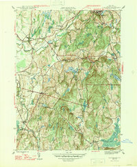
1947 Map of Claverack
USGS Topo · Published 1947About this map
Claverack and Philmont anchor this mid-century portrait of Columbia County, where the landscape transitions from the broad valleys of Claverack Creek to the undulating terrain of Sugarloaf Hill and The Hill. The map captures a moment when rural life centered on dispersed school districts, including School No 12 and School No 7, and small milling centers like Red Mills and Glenco Mills. Industrial and transit corridors are clearly defined by the New York Central and the Albany and Boston lines, which navigate the creek valleys alongside Hollowville Creek and Agawamuck Creek. From the high point at Pinnacle to the wetlands of Texas Swamp and Pumpkin Hollow, the survey documents the intricate drainage patterns and local landmarks that defined these Hudson Valley townships before the acceleration of modern suburban growth.
Find a feature on this map
38 named features on this map. Tap any name to fly to it.
Don’t see what you’re looking for? This feature index may not catch every label — zoom into the map to look around manually.
Map Details
Editions of this 1947 Claverack Map
3 editions found
Other maps of this area

1893 · Coxsackie
USGS Topo · 1:62,500

1894 · Coxsackie
USGS Topo · 1:62,500

1895 · Catskill
USGS Topo · 1:62,500

1902 · Copake
USGS Topo · 1:62,500

1903 · Kinderhook
USGS Topo · 1:62,500

1904 · Copake
USGS Topo · 1:62,500

1929 · Coxsackie
USGS Topo · 1:62,500

1933 · Kinderhook
USGS Topo · 1:62,500

1934 · Catskill
USGS Topo · 1:62,500

1938 · Catskill
USGS Topo · 1:62,500