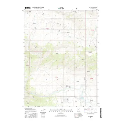
2017 Map of Clay Basin
USGS Topo · Published 2017About this map
The Green River carves through the dramatic landscape of Daggett County, where the southern reaches of the Ashley National Forest meet the high-desert basins of northeast Utah. This survey documents the remote borderlands between the Richards Mountains and the Uinta Mountains, centered on the settlement of Clay Basin and the expansive meadows of Browns Park. Human history is anchored at the river's edge, notably at the John Jarvie Ranch Historic Site Cem, a site preserving the legacy of frontier ranching and commerce. Transport through this complex terrain follows established routes like Browns Park Rd, crossing the water at the Taylor Flat Bridge. From the heights of Two Horse Butte to the depths of Jesse Ewing Canyon, the map illustrates a landscape shaped by both geological forces and the persistence of isolated ranching outposts and conservation efforts like the Browns Park National Wildlife Refuge Reservoir.
Find a feature on this map
36 named features on this map. Tap any name to fly to it.
Don’t see what you’re looking for? This feature index may not catch every label — zoom into the map to look around manually.
Map Details
Editions of this 2017 Clay Basin Map
This is the sole edition of this map. No revisions or reprints were ever made.
Other maps of this area

1885 · Ashley
USGS Topo · 1:250,000

1952 · Warren Draw
USGS Topo · 1:24,000

1952 · Willow Creek Butte
USGS Topo · 1:24,000

1952 · Swallow Canyon
USGS Topo · 1:24,000

1952 · Clay Basin
USGS Topo · 1:24,000

1952 · Goslin Mtn
USGS Topo · 1:24,000

1954 · Vernal
USGS Topo · 1:250,000

1954 · Rock Springs
USGS Topo · 1:250,000

1957 · Currant Creek Ranch
USGS Topo · 1:62,500

1958 · Vernal
USGS Topo · 1:250,000