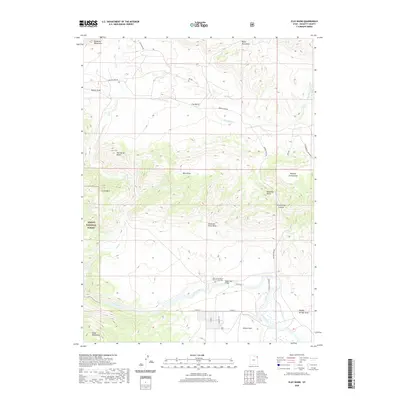
2020 Map of Clay Basin
USGS Topo · Published 2020About this map
Browns Park sits at the southern end of this Daggett County landscape, where the Green River carves a wide valley through the high desert of northeastern Utah. This 2020 map documents a region defined by its dramatic elevation changes, from the heights of Goslin Mtn and the Richards Mountains down to the river basin. Cultural history is anchored at the John Jarvie Ranch Historic Site Cem, a significant marker of early settlement along the river's edge. The transportation network, including the Taylor Flat Bridge and Browns Park Rd, connects the scattered landmarks of Clay Basin to the protected lands of the Ashley National Forest. Small settlements like Mtn Home and natural features such as Two Horse Butte and Jesse Ewing Canyon illustrate a terrain where geological formations dictate the placement of roads and homesteads.
Find a feature on this map
28 named features on this map. Tap any name to fly to it.
Don’t see what you’re looking for? This feature index may not catch every label — zoom into the map to look around manually.
Map Details
Editions of this 2020 Clay Basin Map
This is the sole edition of this map. No revisions or reprints were ever made.
Other maps of this area

1885 · Ashley
USGS Topo · 1:250,000

1952 · Warren Draw
USGS Topo · 1:24,000

1952 · Willow Creek Butte
USGS Topo · 1:24,000

1952 · Swallow Canyon
USGS Topo · 1:24,000

1952 · Clay Basin
USGS Topo · 1:24,000

1952 · Goslin Mtn
USGS Topo · 1:24,000

1954 · Vernal
USGS Topo · 1:250,000

1954 · Rock Springs
USGS Topo · 1:250,000

1957 · Currant Creek Ranch
USGS Topo · 1:62,500

1958 · Vernal
USGS Topo · 1:250,000