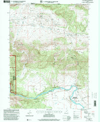
1996 Map of Clay Basin
USGS Topo · Published 2000About this map
Ashley National Forest and the Browns Park Waterfowl Management Area dominate this section of the Utah-Wyoming border, where the Green River carves a deep path through the high desert. The map reveals a landscape defined by natural resource extraction and recreational access, featuring a dense concentration of Gas Wells throughout the northern basin. This industrial footprint at Clay Basin Camp contrasts with the numerous backcountry sites along the river, such as Fire Flat Camp, Elm Grove Camp, and Airstrip Camp. Significant river crossings and access points like the Taylor Flat Bridge and Raft Ramp highlight the area's importance for water-based transit. The terrain is marked by prominent geological features including Two Horse Butte and Band Box Butte, while drainage systems like Jesse Ewing Canyon feed into the river valley.
Find a feature on this map
36 named features on this map. Tap any name to fly to it.
Don’t see what you’re looking for? This feature index may not catch every label — zoom into the map to look around manually.
Map Details
Editions of this 1996 Clay Basin Map
This is the sole edition of this map. No revisions or reprints were ever made.
Other maps of this area

1885 · Ashley
USGS Topo · 1:250,000

1952 · Warren Draw
USGS Topo · 1:24,000

1952 · Willow Creek Butte
USGS Topo · 1:24,000

1952 · Swallow Canyon
USGS Topo · 1:24,000

1952 · Clay Basin
USGS Topo · 1:24,000

1952 · Goslin Mtn
USGS Topo · 1:24,000

1954 · Vernal
USGS Topo · 1:250,000

1954 · Rock Springs
USGS Topo · 1:250,000

1957 · Currant Creek Ranch
USGS Topo · 1:62,500

1958 · Vernal
USGS Topo · 1:250,000