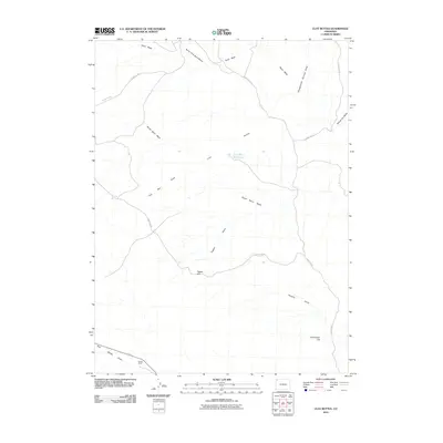
2010 Map of Clay Buttes
USGS Topo · Published 2010About this map
Clay Buttes and its namesake Clay Buttes Reservoir anchor this arid Moffat County landscape, where water management and ranching define the geography. The map reveals a complex network of seasonal drainages, including the bifurcated Sand Wash, North Fork Sand Wash, and South Sand Wash, which carve through the high desert terrain. Notable landmarks like Pigpen Hill and Monument Hill rise above the washes, providing navigational points in a region largely dominated by open range. Settlement is sparse, represented by Solace Ranch in the southwest corner near East Boone Draw. A system of maintained gravel routes, such as County Rd-126 and County Rd-80, facilitates movement across the draws, connecting isolated water sources like Two Bar Springs to the broader county infrastructure.
Find a feature on this map
19 named features on this map. Tap any name to fly to it.
Don’t see what you’re looking for? This feature index may not catch every label — zoom into the map to look around manually.
Map Details
Editions of this 2010 Clay Buttes Map
This is the sole edition of this map. No revisions or reprints were ever made.
Other maps of this area

1954 · Vernal
USGS Topo · 1:250,000

1958 · Vernal
USGS Topo · 1:250,000

1960 · Vernal
USGS Topo · 1:250,000

1960 · Lone Mountain
USGS Topo · 1:62,500

1966 · G Spring
USGS Topo · 1:24,000
1966 · Limestone Hill
USGS Topo · 1:24,000

1966 · Sheephead Basin
USGS Topo · 1:24,000

1969 · Sheepherder Springs
USGS Topo · 1:24,000
1969 · Lang Spring
USGS Topo · 1:24,000
1979 · Canyon of Lodore
USGS Topo · 1:100,000