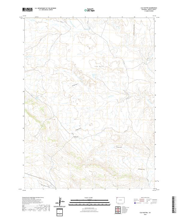
2022 Map of Clay Buttes
USGS Topo · Published 2022About this map
Clay Buttes and the surrounding high desert terrain dominate this corner of Moffat County, where life revolves around water management in an arid landscape. The Clay Buttes Reservoir and Two Bar Springs represent vital water points in a geography defined by intricate drainage networks like the Sheepherder Springs Draw and Sand Wash. The naming conventions found throughout the sheet, such as Pigpen Hill and Pigpen Draw, reflect the region's livestock history and the practicalities of ranching in Northwest Colorado. Rising above the draws, Monument Hill serves as a prominent landmark for navigation across the high plateaus. A network of county routes, including Co RD 80 and Co RD 48, trace the paths of least resistance through the breaks and draws, connecting this remote area to the broader county infrastructure.
Find a feature on this map
23 named features on this map. Tap any name to fly to it.
Don’t see what you’re looking for? This feature index may not catch every label — zoom into the map to look around manually.
Map Details
Editions of this 2022 Clay Buttes Map
This is the sole edition of this map. No revisions or reprints were ever made.
Other maps of this area

1954 · Vernal
USGS Topo · 1:250,000

1958 · Vernal
USGS Topo · 1:250,000

1960 · Vernal
USGS Topo · 1:250,000

1960 · Lone Mountain
USGS Topo · 1:62,500

1966 · G Spring
USGS Topo · 1:24,000
1966 · Limestone Hill
USGS Topo · 1:24,000

1966 · Sheephead Basin
USGS Topo · 1:24,000

1969 · Sheepherder Springs
USGS Topo · 1:24,000
1969 · Lang Spring
USGS Topo · 1:24,000
1979 · Canyon of Lodore
USGS Topo · 1:100,000