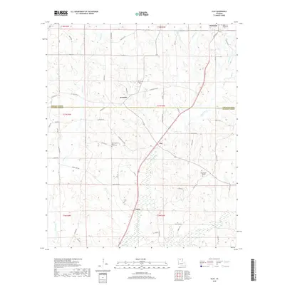
2018 Map of Clay
USGS Topo · Published 2018About this map
Lincoln and Jackson Parishes meet in this North Louisiana landscape, where the settlements of Woodville, Clay, and Ansley are linked by a network of rural roads and parish routes. The terrain is defined by the drainage systems of Redwine Creek and Sugar Creek, alongside the wetland reaches of Cypress Bayou. Genealogists will find significant detail in the numerous burial sites and rural congregations that anchor these communities, including the Wesley Chapel Cem and the New Prosperity Baptist Church Cem. The map documents a transition from the rolling timberlands of the north to the more marshy environments associated with Sugar Creek in the south, reflecting the traditional agricultural and forestry patterns of the region. A clear view of historical transit is visible in the alignment of Old State Rd and the various parish connectors like Bridge Creek Rd.
Find a feature on this map
67 named features on this map. Tap any name to fly to it.
Don’t see what you’re looking for? This feature index may not catch every label — zoom into the map to look around manually.
Map Details
Editions of this 2018 Clay Map
This is the sole edition of this map. No revisions or reprints were ever made.
Other maps of this area

1947 · Bienville
USGS Topo · 1:62,500

1949 · Bienville
USGS Topo · 1:62,500

1950 · Ruston
USGS Topo · 1:62,500

1950 · Arcadia
USGS Topo · 1:62,500

1951 · Arcadia
USGS Topo · 1:62,500

1951 · Ruston
USGS Topo · 1:62,500

1953 · Hodge
USGS Topo · 1:62,500

1955 · Shreveport
USGS Topo · 1:250,000

1956 · Shreveport
USGS Topo · 1:250,000

1984 · Shreveport
USGS Topo · 1:250,000