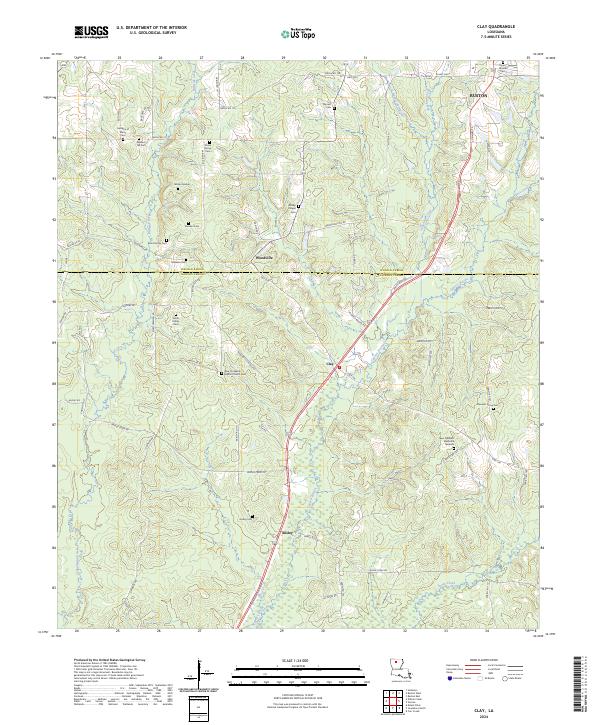
2024 Map of Clay
USGS Topo · Published 2024About this map
Cypress Bayou winds through the heart of this North Louisiana landscape, where the boundary between Lincoln Parish and Jackson Parish divides a region defined by small settlements and family history. The southern outskirts of Ruston reach into the northeast, while the smaller communities of Woodville, Clay, and Ansley follow the transportation corridors that cut through the undulating piney woods.
Find a feature on this map
92 named features on this map. Tap any name to fly to it.
Don’t see what you’re looking for? This feature index may not catch every label — zoom into the map to look around manually.
Map Details
Editions of this 2024 Clay Map
This is the sole edition of this map. No revisions or reprints were ever made.
Other maps of this area

1947 · Bienville
USGS Topo · 1:62,500

1949 · Bienville
USGS Topo · 1:62,500

1950 · Ruston
USGS Topo · 1:62,500

1950 · Arcadia
USGS Topo · 1:62,500

1951 · Arcadia
USGS Topo · 1:62,500

1951 · Ruston
USGS Topo · 1:62,500

1953 · Hodge
USGS Topo · 1:62,500

1955 · Shreveport
USGS Topo · 1:250,000

1956 · Shreveport
USGS Topo · 1:250,000

1984 · Shreveport
USGS Topo · 1:250,000