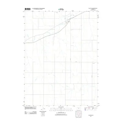
2012 Map of Clayton
USGS Topo · Published 2012About this map
The town of Main St serves as the focal point for this section of Norton County, where the local street grid including Kansas Ave and Railroad Ave meets the natural drainage of the High Plains. The landscape is defined by a series of south-to-north flowing waterways, most notably Prairie Dog Creek, which is joined by tributaries like Plum Creek and Big Timber Creek. To the south, the terrain is carved by the winding path of Elk Creek, illustrating the characteristic erosion patterns of the western Kansas prairie.
Find a feature on this map
11 named features on this map. Tap any name to fly to it.
Don’t see what you’re looking for? This feature index may not catch every label — zoom into the map to look around manually.
Map Details
Editions of this 2012 Clayton Map
This is the sole edition of this map. No revisions or reprints were ever made.
Other maps of this area

1951 · Norcatur
USGS Topo · 1:62,500

1951 · Kanona
USGS Topo · 1:62,500

1954 · Goodland
USGS Topo · 1:250,000

1956 · Goodland
USGS Topo · 1:250,000

1957 · Goodland
USGS Topo · 1:250,000

1965 · Kanona SE
USGS Topo · 1:24,000

1978 · Clayton SW
USGS Topo · 1:24,000

1978 · Clayton
USGS Topo · 1:24,000
1978 · Jennings
USGS Topo · 1:24,000

1978 · Allison
USGS Topo · 1:24,000