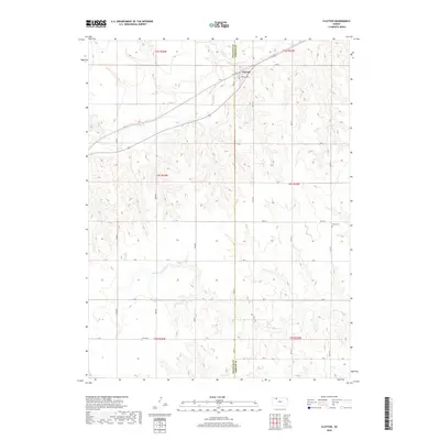
2018 Map of Clayton
USGS Topo · Published 2018About this map
Clayton serves as the central hub of this Kansas landscape, straddling the border between Decatur and Norton counties. The settlement is defined by a traditional grid including Main St, Kansas Ave, and Railroad Ave, reflecting its historical orientation toward regional transportation. The surrounding countryside is deeply dissected by a network of drainage systems, most notably Prairie Dog Cr and Plum Cr, which carve through the high plains terrain. Local history and genealogy are anchored by the Gettis Cem located to the southeast, while the broader rural landscape is marked by a series of sections including Elk Cr and Big Timber Cr. The survey illustrates the precise Township and Range divisions of the Public Land Survey System, which continue to dictate the placement of rural corridors like Road S and Co Rd 352.
Find a feature on this map
33 named features on this map. Tap any name to fly to it.
Don’t see what you’re looking for? This feature index may not catch every label — zoom into the map to look around manually.
Map Details
Editions of this 2018 Clayton Map
This is the sole edition of this map. No revisions or reprints were ever made.
Other maps of this area

1951 · Norcatur
USGS Topo · 1:62,500

1951 · Kanona
USGS Topo · 1:62,500

1954 · Goodland
USGS Topo · 1:250,000

1956 · Goodland
USGS Topo · 1:250,000

1957 · Goodland
USGS Topo · 1:250,000

1965 · Kanona SE
USGS Topo · 1:24,000

1978 · Clayton SW
USGS Topo · 1:24,000

1978 · Clayton
USGS Topo · 1:24,000
1978 · Jennings
USGS Topo · 1:24,000

1978 · Allison
USGS Topo · 1:24,000