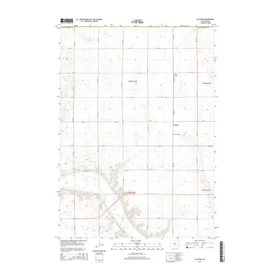
2015 Map of Clayton
USGS Topo · Published 2015About this map
The small unincorporated community of Clayton serves as the central landmark for this section of southeastern South Dakota. Situated within Hutchinson Co, the landscape is defined by the winding course of the James River as it cuts through the southwestern corner of the quadrangle. The township structure is clearly delineated by a regular grid of section roads, including 427th Ave and 272nd St, which connect various farmstead sites across the prairie. Notable for local genealogists and historians are the local burial grounds, specifically the Clayton Cemetary north of the settlement and Rademacher Cem further south. Minor watercourses like Plum Cr and Elm Cr provide drainage for the surrounding agricultural fields, illustrating the hydrology that has shaped the settlement patterns of this rural region.
Find a feature on this map
28 named features on this map. Tap any name to fly to it.
Don’t see what you’re looking for? This feature index may not catch every label — zoom into the map to look around manually.
Map Details
Editions of this 2015 Clayton Map
This is the sole edition of this map. No revisions or reprints were ever made.
Other maps of this area

1898 · Olivet
USGS Topo · 1:125,000

1899 · Alexandria
USGS Topo · 1:125,000

1955 · Sioux Falls
USGS Topo · 1:250,000

1957 · Tschetter Colony
USGS Topo · 1:24,000

1957 · Milltown
USGS Topo · 1:24,000

1957 · Clayton
USGS Topo · 1:24,000

1957 · Wolf Creek
USGS Topo · 1:24,000

1957 · Rockport Colony
USGS Topo · 1:24,000

1958 · Sioux Falls
USGS Topo · 1:250,000

1970 · Clayton NE
USGS Topo · 1:24,000