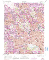
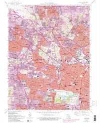
1954 Map of Clayton
USGS Topo · Published 1991About this map
The dense urban and suburban landscape of St. Louis County is captured here in the mid-1950s, showing a transition toward heavy development surrounding Lambert-St Louis Airport. The area is a hub of education and institutional history, anchored by the sprawling campus of Washington University and the nearby Concordia Seminary and Fontbonne College. Commercial and residential expansion is evident along major thoroughfares like Natural Bridge Road and Page Blvd, while the Wabash Railroad maintains its industrial footprint.
Find a feature on this map
136 named features on this map. Tap any name to fly to it.
Don’t see what you’re looking for? This feature index may not catch every label — zoom into the map to look around manually.
Map Details
Editions of this 1954 Clayton Map
6 editions found
Other maps of this area

1888 · St. Louis
USGS Topo · 1:62,500

1924 · Robertson
USGS Topo · 1:24,000

1927 · Alton
USGS Topo · 1:62,500

1927 · St. Charles
USGS Topo · 1:62,500

1933 · Creve Coeur
USGS Topo · 1:24,000

1933 · Granite City
USGS Topo · 1:24,000

1933 · Jefferson Barracks
USGS Topo · 1:24,000

1933 · Cahokia
USGS Topo · 1:24,000

1933 · Clayton
USGS Topo · 1:24,000

1933 · Saint Charles
USGS Topo · 1:62,500