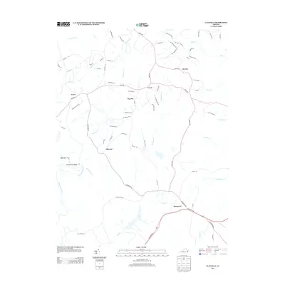
2013 Map of Clayville
USGS Topo · Published 2013About this map
The Appomattox River winds through the southwestern corner of this landscape, defining the border near Mattoax and Goode Crossing. The interior is characterized by a network of small settlements and post offices connected by a web of rural roads, including Genito, Clayville, and Dorset. This area serves as a significant drainage basin for several major tributaries, with Butterwood Cr, Skinquarter Cr, and Swift Cr carving paths through the terrain.
Find a feature on this map
72 named features on this map. Tap any name to fly to it.
Don’t see what you’re looking for? This feature index may not catch every label — zoom into the map to look around manually.
Map Details
Editions of this 2013 Clayville Map
This is the sole edition of this map. No revisions or reprints were ever made.
Other maps of this area

1890 · Goochland
USGS Topo · 1:125,000

1892 · Goochland
USGS Topo · 1:125,000

1897 · Amelia
USGS Topo · 1:125,000

1943 · Fine Creek Mills
USGS Topo · 1:31,680

1943 · Powhatan
USGS Topo · 1:31,680

1943 · Amelia
USGS Topo · 1:31,680

1943 · Goodes Bridge
USGS Topo · 1:31,680

1943 · Hallsboro
USGS Topo · 1:31,680

1943 · Clayville
USGS Topo · 1:24,000

1943 · Midlothian
USGS Topo · 1:24,000