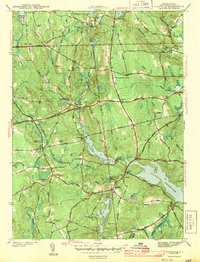
1943 Map of Clayville
USGS Topo · Published 1943About this map
Clayville and Rockland sit at the edge of a landscape transformed by water management in the mid-20th century. The village centers are positioned alongside the Scituate Reservoir, Barden Reservoir, and Westconnuag Reservoir, reflecting the area's role as a vital watershed for the region. Historical family and community ties are evident in the numerous small burial grounds, such as the New Rockland Cem and the Hopkins Mills Cem, as well as named family sites like the Stone Plot and Old Howard Plot.
Find a feature on this map
65 named features on this map. Tap any name to fly to it.
Don’t see what you’re looking for? This feature index may not catch every label — zoom into the map to look around manually.
Map Details
Editions of this 1943 Clayville Map
4 editions found
Other maps of this area

1889 · Putnam
USGS Topo · 1:62,500

1889 · Burrillville
USGS Topo · 1:62,500

1889 · Moosup
USGS Topo · 1:62,500

1890 · Kent
USGS Topo · 1:62,500

1893 · Putnam
USGS Topo · 1:62,500

1893 · Moosup
USGS Topo · 1:62,500

1894 · Burrillville
USGS Topo · 1:62,500

1894 · Kent
USGS Topo · 1:62,500

1915 · Burrillville
USGS Topo · 1:62,500

1919 · Putnam
USGS Topo · 1:62,500