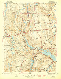
1943 Map of Clayville
USGS Topo · Published 1943About this map
Barden Reservoir and the western reaches of the Scituate Reservoir dominate this mid-century landscape in Providence County, Rhode Island. The map reveals the sophisticated system of water management and topography across the towns of Foster, Glocester, and Scituate. Large tracts of land are defined by prominent hills like Chopmist Hill and Pray Hill, while smaller settlements such as Clayville and Rockland are located at critical road junctions near the water's edge.
Find a feature on this map
67 named features on this map. Tap any name to fly to it.
Don’t see what you’re looking for? This feature index may not catch every label — zoom into the map to look around manually.
Map Details
Editions of this 1943 Clayville Map
4 editions found
Other maps of this area

1889 · Putnam
USGS Topo · 1:62,500

1889 · Burrillville
USGS Topo · 1:62,500

1889 · Moosup
USGS Topo · 1:62,500

1890 · Kent
USGS Topo · 1:62,500

1893 · Putnam
USGS Topo · 1:62,500

1893 · Moosup
USGS Topo · 1:62,500

1894 · Burrillville
USGS Topo · 1:62,500

1894 · Kent
USGS Topo · 1:62,500

1915 · Burrillville
USGS Topo · 1:62,500

1919 · Putnam
USGS Topo · 1:62,500