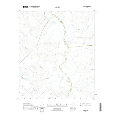
2019 Map of Clear Lake
USGS Topo · Published 2019About this map
The Navasota River carves a winding path along the triple border of Brazos, Madison, and Grimes counties, anchoring a landscape defined by its riparian wetlands and cattle ranching infrastructure. This 2019 survey illustrates the rural transition of East Texas, where traditional landholdings are marked by sites like Tryson Cem and Williamson Cem. The terrain is deeply textured by drainage systems such as Big Slough, Allcorn Cr, and Sand Cr, which feed into numerous localized water bodies including Clear Lake and Wickson Lake. Extensive road networks like Mary Barton Rd and Tauber Ranch Rd provide access to the interior, reflecting the area's continued reliance on agricultural and ranching access. The presence of named features like Old Cedar Creek and Robertson Br highlights the significance of water management in this part of the Post Oak Savannah.
Find a feature on this map
61 named features on this map. Tap any name to fly to it.
Don’t see what you’re looking for? This feature index may not catch every label — zoom into the map to look around manually.
Map Details
Editions of this 2019 Clear Lake Map
This is the sole edition of this map. No revisions or reprints were ever made.
Other maps of this area

1925 · Iola No 2
USGS Topo · 1:48,000

1931 · Iola
USGS Topo · 1:62,500

1954 · Austin
USGS Topo · 1:250,000

1956 · Bryan
USGS Topo · 1:62,500

1956 · Carlos
USGS Topo · 1:62,500

1959 · Clear Lake
USGS Topo · 1:24,000

1959 · Reliance
USGS Topo · 1:24,000

1962 · Edge
USGS Topo · 1:24,000

1962 · Keith
USGS Topo · 1:24,000

1962 · Bryan East
USGS Topo · 1:24,000