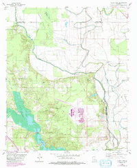
1980 Map of Clear Lake
USGS Topo · Published 1992About this map
Bayou Pierre and the Prairie River define the intricate alluvial landscape of the Red River Valley south of Shreveport, where parish boundaries for Caddo, Red River, and De Soto meet. The 1980 topography shows a transition from the marshy expanses of Smithport Lake and Clear Lake to the engineered infrastructure of the Pascagoula Canal and numerous pipelines. Local communities are anchored by landmarks such as New Friendship Church and its associated cemetery, alongside other rural congregations like Willow Bayou Church and Sunshine Church. Industrial development is evident through an active oil field and a concentration of gas wells, while the Road on Levee highlights the ongoing efforts to manage the complex drainage of Cannisnia Lake and Boggy Bayou.
Find a feature on this map
37 named features on this map. Tap any name to fly to it.
Don’t see what you’re looking for? This feature index may not catch every label — zoom into the map to look around manually.
Map Details
Editions of this 1980 Clear Lake Map
2 editions found
Other maps of this area

1941 · East Point
USGS Topo · 1:31,680

1941 · Bossier Point
USGS Topo · 1:31,680

1945 · Mansfield
USGS Topo · 1:62,500

1947 · Ringgold
USGS Topo · 1:62,500

1947 · Mansfield
USGS Topo · 1:62,500

1948 · Coushatta
USGS Topo · 1:62,500

1948 · Caspiana
USGS Topo · 1:62,500

1955 · Shreveport
USGS Topo · 1:250,000

1955 · Caspiana
USGS Topo · 1:62,500

1956 · Shreveport
USGS Topo · 1:250,000