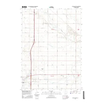
2015 Map of Clear Lake East
USGS Topo · Published 2015About this map
Mason City Municipal Airport anchors the central landscape of this Cerro Gordo County survey, situated between the growing city limits and the agricultural prairie to the north. The area is defined by a dendritic network of waterways, including the Winnebago River and its various tributaries such as Calmus Cr and Wharam Cr. These streams cut through a grid of rural roads named for native flora and fauna, including Jonquil Ave, Juniper Ave, and Killdeer Ave. To the southeast, the small settlement of Emery sits along the transit corridor leading toward the urban center. Local history is preserved in several burial grounds like Lincoln Cem and Memorial Park Cem, while the western edge of the map captures the residential and recreational outskirts near the Clear Lake Cem.
Find a feature on this map
60 named features on this map. Tap any name to fly to it.
Don’t see what you’re looking for? This feature index may not catch every label — zoom into the map to look around manually.
Map Details
Editions of this 2015 Clear Lake East Map
This is the sole edition of this map. No revisions or reprints were ever made.
Other maps of this area

1954 · Mason City
USGS Topo · 1:250,000

1957 · Mason City
USGS Topo · 1:250,000

1958 · Mason City
USGS Topo · 1:250,000

1959 · Mason City
USGS Topo · 1:24,000

1959 · Mason City
USGS Topo · 1:62,500

1959 · Hanford
USGS Topo · 1:24,000

1972 · Clear Lake West
USGS Topo · 1:24,000

1972 · Manly
USGS Topo · 1:24,000

1972 · Fertile
USGS Topo · 1:24,000

1972 · Burchinal
USGS Topo · 1:24,000