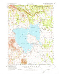
1951 Map of Clear Lake Reservoir
USGS Topo · Published 1973About this map
Clear Lake Reservoir and its surrounding high-desert plateau dominate this 1951 survey, situated along the State Line of California and Oregon. The map documents a landscape defined by water management and ranching, where the Lost River enters from the north and various springs like Mammoth Sprs and Fiddlers Green sustain local holdings. This era shows the established presence of the Clear Lake National Wildlife Refuge and Modoc National Forest, protecting the habitat around Bird Island.
Find a feature on this map
51 named features on this map. Tap any name to fly to it.
Don’t see what you’re looking for? This feature index may not catch every label — zoom into the map to look around manually.
Map Details
Editions of this 1951 Clear Lake Reservoir Map
5 editions found
Other maps of this area

1886 · Alturas
USGS Topo · 1:250,000

1886 · Modoc Lava Bed
USGS Topo · 1:250,000

1889 · Klamath
USGS Topo · 1:250,000

1892 · Modoc Lava-Bed
USGS Topo · 1:250,000

1892 · Alturas
USGS Topo · 1:250,000

1894 · Klamath
USGS Topo · 1:250,000

1951 · Clear Lake Reservoir
USGS Topo · 1:62,500

1951 · Tulelake
USGS Topo · 1:62,500

1952 · Timber Mountain
USGS Topo · 1:62,500

1952 · Hackamore
USGS Topo · 1:62,500