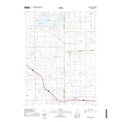
2019 Map of Clear Lake
USGS Topo · Published 2019About this map
Clear Lake serves as the focal point of this tri-state border region where Indiana, Michigan, and Ohio converge. The shoreline is densely developed with private drives and access points like Paradise Point, while smaller water bodies such as Mirror Lake and Handy Lake lie just to the north. Further south, the landscape transitions into agricultural plots and wooded wetlands, drained by W Br Fish Cr and Nettle Cr. Local history is preserved through a series of rural burying grounds, including Teeters Cem and Rogers Cem, which are scattered among small unincorporated settlements.
Find a feature on this map
67 named features on this map. Tap any name to fly to it.
Don’t see what you’re looking for? This feature index may not catch every label — zoom into the map to look around manually.
Map Details
Editions of this 2019 Clear Lake Map
This is the sole edition of this map. No revisions or reprints were ever made.
Other maps of this area

1914 · Pioneer
USGS Topo · 1:62,500

1939 · Hamilton
USGS Topo · 1:24,000

1939 · Angola East
USGS Topo · 1:24,000

1939 · Clear Lake
USGS Topo · 1:24,000

1940 · Metz
USGS Topo · 1:24,000

1940 · Clear Lake
USGS Topo · 1:24,000

1944 · Pioneer
USGS Topo · 1:62,500

1947 · Angola East
USGS Topo · 1:24,000

1948 · Hamilton
USGS Topo · 1:24,000

1953 · Fort Wayne
USGS Topo · 1:250,000