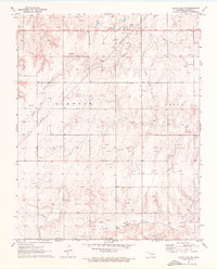
1971 Map of Clear Lake SW
USGS Topo · Published 1976About this map
The rolling plains of Beaver County meet the Texas border in this 1971 record of the High Plains landscape. The area is defined by the massive infrastructure of the Elmwood Oil and Gas Field and the Logan Oil and Gas Field, where a dense network of pipelines, oil wells, and gas wells crisscrosses the terrain. These industrial features contrast with the rural heritage of the region, anchored by established landmarks such as the South Flat Ch and the Mountain View Ch.
Find a feature on this map
21 named features on this map. Tap any name to fly to it.
Don’t see what you’re looking for? This feature index may not catch every label — zoom into the map to look around manually.
Map Details
Editions of this 1971 Clear Lake SW Map
2 editions found
Other maps of this area

1954 · Perryton
USGS Topo · 1:250,000

1958 · Perryton
USGS Topo · 1:250,000

1971 · Clear Lake NW
USGS Topo · 1:24,000

1971 · Clear Lake SW
USGS Topo · 1:24,000

1971 · Clear Lake
USGS Topo · 1:24,000

1971 · Clear Lake SE
USGS Topo · 1:24,000

1972 · Darrouzett
USGS Topo · 1:24,000

1972 · Gaylord
USGS Topo · 1:24,000

1973 · Booker
USGS Topo · 1:24,000

1973 · Balko NE
USGS Topo · 1:24,000