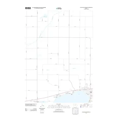
2013 Map of Clear Lake West
USGS Topo · Published 2013About this map
Clear Lake dominates the southern portion of this landscape, its western shoreline defining the community of Ventura. This modern survey reveals a highly structured agricultural grid in the surrounding northern territory, punctuated by the winding course of the Winnebago River and the wetlands of Mallard Marsh Swamp. The lakefront itself is densely developed, featuring recreational landmarks such as the Iowa Regular Baptist Camp, All Vets Golf Course, and Relly Point.
Find a feature on this map
67 named features on this map. Tap any name to fly to it.
Don’t see what you’re looking for? This feature index may not catch every label — zoom into the map to look around manually.
Map Details
Editions of this 2013 Clear Lake West Map
This is the sole edition of this map. No revisions or reprints were ever made.
Other maps of this area

1954 · Mason City
USGS Topo · 1:250,000

1957 · Mason City
USGS Topo · 1:250,000

1958 · Mason City
USGS Topo · 1:250,000

1972 · Clear Lake West
USGS Topo · 1:24,000

1972 · Fertile
USGS Topo · 1:24,000

1972 · Burchinal
USGS Topo · 1:24,000
1972 · Clear Lake East
USGS Topo · 1:24,000
1972 · Fertile SE
USGS Topo · 1:24,000

1972 · Pilot Knob
USGS Topo · 1:24,000
1972 · Ventura Heights
USGS Topo · 1:24,000