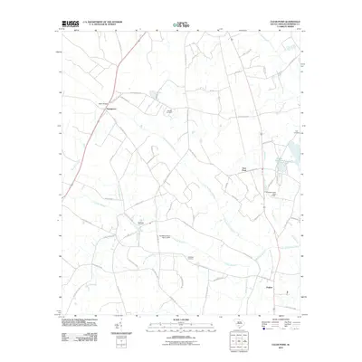
2011 Map of Clear Pond
USGS Topo · Published 2011About this map
The Little Salkehatchie River winds through this rural landscape of Bamberg County, defining a region where agricultural land meets dense wetlands. The small settlement of Springtown is situated in the northwest, near the Odom Bridge crossing, while Hughes sits at a crossroads to the southeast. Family history is etched into the terrain through scattered burial grounds, including Mitchell Cemetery, Folk Cemetery, and McMillian Cemetery, which serve as quiet markers of the area's long-standing community roots.
Find a feature on this map
61 named features on this map. Tap any name to fly to it.
Don’t see what you’re looking for? This feature index may not catch every label — zoom into the map to look around manually.
Map Details
Editions of this 2011 Clear Pond Map
This is the sole edition of this map. No revisions or reprints were ever made.
Other maps of this area

1919 · Olar
USGS Topo · 1:62,500

1919 · Bamberg
USGS Topo · 1:48,000

1919 · Lodge
USGS Topo · 1:62,500

1920 · Lodge
USGS Topo · 1:48,000

1920 · Bamberg
USGS Topo · 1:62,500

1920 · Orangeburg
USGS Topo · 1:48,000

1921 · Orangeburg
USGS Topo · 1:62,500

1921 · Lodge
USGS Topo · 1:62,500

1943 · Olar
USGS Topo · 1:62,500

1943 · Lodge
USGS Topo · 1:62,500