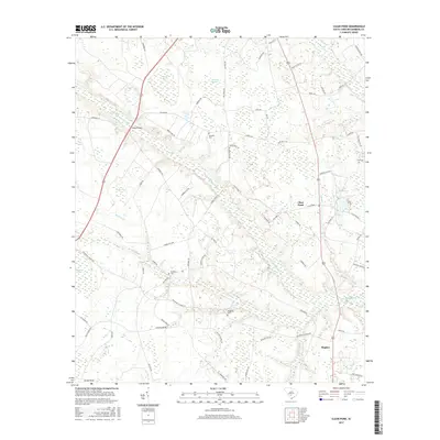
2017 Map of Clear Pond
USGS Topo · Published 2017About this map
The Little Salkehatchie River and its numerous tributaries, including Colston Br and Indian Camp Br, define this low-lying region of Bamberg County. This 2017 survey illustrates the complex hydrology of the South Carolina Coastal Plain, where the river's path is joined by distinct water bodies such as Clear Pond and Little Clear Pond, alongside specialized wetland features like Sutton Bay and Brunston Swamp. The settlement of Hughes serves as a small population center in an otherwise rural landscape dominated by timberland and agriculture.
Find a feature on this map
70 named features on this map. Tap any name to fly to it.
Don’t see what you’re looking for? This feature index may not catch every label — zoom into the map to look around manually.
Map Details
Editions of this 2017 Clear Pond Map
This is the sole edition of this map. No revisions or reprints were ever made.
Other maps of this area

1919 · Olar
USGS Topo · 1:62,500

1919 · Bamberg
USGS Topo · 1:48,000

1919 · Lodge
USGS Topo · 1:62,500

1920 · Lodge
USGS Topo · 1:48,000

1920 · Bamberg
USGS Topo · 1:62,500

1920 · Orangeburg
USGS Topo · 1:48,000

1921 · Orangeburg
USGS Topo · 1:62,500

1921 · Lodge
USGS Topo · 1:62,500

1943 · Olar
USGS Topo · 1:62,500

1943 · Lodge
USGS Topo · 1:62,500