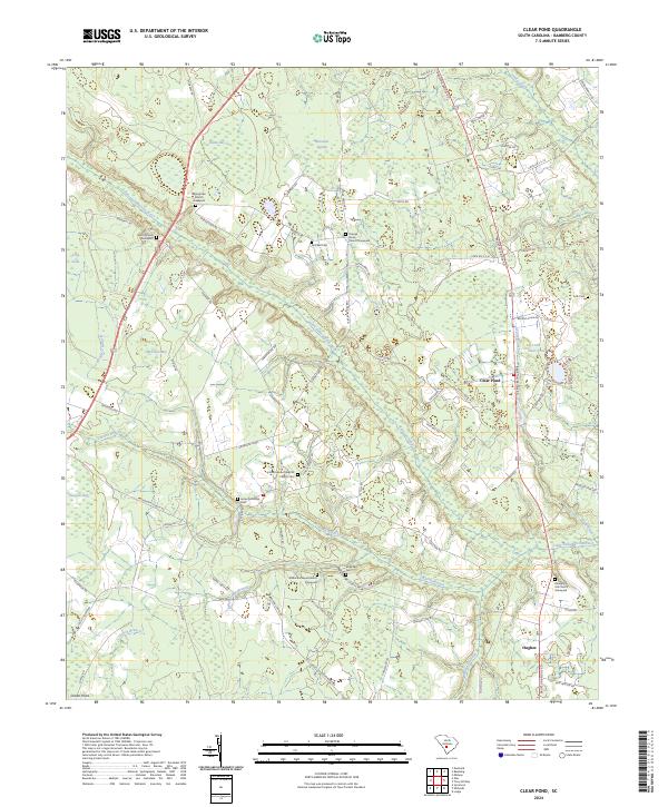
2024 Map of Clear Pond
USGS Topo · Published 2024About this map
The Little Salkehatchie River meanders through the heart of this landscape, flanked by a dense network of wetlands including Brunston Swamp, Sutton Bay, and Ben Rice Bay. This area of Bamberg County is characterized by a high concentration of spiritual and commemorative sites, reflecting a deeply rooted local community. Genealogists and researchers will find numerous family-centric landmarks such as the James McMillan Cem, Mitchell Cem, and Folk Cem. Small rural congregations serve as central points for the scattered settlements, with Springtown Church in the northwest and Colston Branch Baptist Church further south. The settlement of Hughes sits near the southeastern corner, connected by Broxton Bridge Rd, illustrating a pattern of development where small-scale farming and timber interests are integrated with the various branches and creeks like Colston Branch and Indian Camp Branch.
Find a feature on this map
81 named features on this map. Tap any name to fly to it.
Don’t see what you’re looking for? This feature index may not catch every label — zoom into the map to look around manually.
Map Details
Editions of this 2024 Clear Pond Map
This is the sole edition of this map. No revisions or reprints were ever made.
Other maps of this area

1919 · Olar
USGS Topo · 1:62,500

1919 · Bamberg
USGS Topo · 1:48,000

1919 · Lodge
USGS Topo · 1:62,500

1920 · Lodge
USGS Topo · 1:48,000

1920 · Bamberg
USGS Topo · 1:62,500

1920 · Orangeburg
USGS Topo · 1:48,000

1921 · Orangeburg
USGS Topo · 1:62,500

1921 · Lodge
USGS Topo · 1:62,500

1943 · Olar
USGS Topo · 1:62,500

1943 · Lodge
USGS Topo · 1:62,500