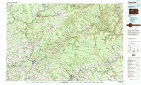
1983 Map of Clearfield
USGS Topo · Published 1984About this map
The Allegheny Mountains define the character of this 1983 survey, where heavy industry and vast public lands converge in north-central Pennsylvania. Extensive tracts of the Allegheny National Forest, Elk State Forest, and Moshannon State Forest dominate the landscape, interrupted by the deep valleys of the West Branch Susquehanna River and the Clarion River. This era shows the region as a critical energy and transit corridor, featuring active resource extraction at Dagus Mines and Coal Hollow.
Find a feature on this map
182 named features on this map. Tap any name to fly to it.
Don’t see what you’re looking for? This feature index may not catch every label — zoom into the map to look around manually.
Map Details
Editions of this 1983 Clearfield Map
This is the sole edition of this map. No revisions or reprints were ever made.
Other maps of this area

1903 · Curwensville
USGS Topo · 1:62,500

1903 · Houtzdale
USGS Topo · 1:62,500

1905 · Houtzdale
USGS Topo · 1:62,500

1906 · Punxsutawney
USGS Topo · 1:62,500

1908 · Bellefonte
USGS Topo · 1:62,500

1909 · Bellefonte
USGS Topo · 1:62,500

1909 · Smicksburg
USGS Topo · 1:62,500

1918 · Loleta
USGS Topo · 1:62,500

1922 · Philipsburg
USGS Topo · 1:62,500

1922 · Du Bois
USGS Topo · 1:62,500