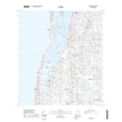
2021 Map of Clearwater
USGS Topo · Published 2021About this map
Sand Key and its string of coastal communities including Belleair Beach and Indian Rocks Beach define the barrier landscape of this contemporary Pinellas County survey. The map details the complex geography of the Intracoastal Waterway as it moves through Clearwater Harbor and Clearwater Bay, separating the mainland from the Gulf Of Mexico. Local history and genealogy are anchored by sites such as the Rousseau Pioneer Cem and Chapel Hill Memorial Park, while the urban landscape of Clearwater and Largo shows dense residential development and institutional landmarks like the Clearwater Courthouse. The presence of the Florida Circumnavigational Paddling Trl and the Clearwater Beach Trail Spur Trl highlights the modern emphasis on recreational corridors through these established coastal corridors, connecting the mainland from Dunedin down to Seminole.
Find a feature on this map
61 named features on this map. Tap any name to fly to it.
Don’t see what you’re looking for? This feature index may not catch every label — zoom into the map to look around manually.
Map Details
Editions of this 2021 Clearwater Map
This is the sole edition of this map. No revisions or reprints were ever made.
Other maps of this area

1921 · Sand Key
USGS Topo · 1:62,500

1921 · St Petersburg
USGS Topo · 1:62,500

1943 · St Petersburg
USGS Topo · 1:31,680

1943 · Bay Pines
USGS Topo · 1:31,680

1943 · Safety Harbor
USGS Topo · 1:31,680

1943 · Dunedin
USGS Topo · 1:31,680

1943 · Clearwater
USGS Topo · 1:24,000

1943 · Oldsmar
USGS Topo · 1:24,000

1944 · Oldsmar
USGS Topo · 1:31,680

1947 · St Petersburg
USGS Topo · 1:25,000