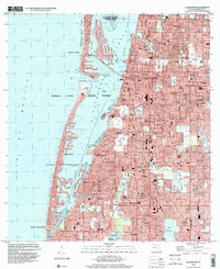
1995 Map of Clearwater
USGS Topo · Published 2000About this map
Clearwater and its surrounding coastal communities are shown in dense detail following the mid-1990s development boom. The map illustrates the complex relationship between the urban mainland and the fragile barrier islands, connected by the Memorial Causeway and Belleair Causeway. Beyond the residential grids of Dunedin and Largo, the landscape is defined by its commitment to maritime preservation and recreation, visible in the Caladesi Island State Park and the expansive Clearwater Aquatic Preserve. Local history is anchored by numerous neighborhood institutions, from the Plant Hospital near the waterfront to small community centers like Anona and Baskin. Educational and religious landmarks, such as Skycrest Sch and Highland Ch, provide a granular look at the suburban infrastructure that matured in Pinellas County during the late 20th century.
Find a feature on this map
85 named features on this map. Tap any name to fly to it.
Don’t see what you’re looking for? This feature index may not catch every label — zoom into the map to look around manually.
Map Details
Editions of this 1995 Clearwater Map
This is the sole edition of this map. No revisions or reprints were ever made.
Other maps of this area

1921 · Sand Key
USGS Topo · 1:62,500

1921 · St Petersburg
USGS Topo · 1:62,500

1943 · St Petersburg
USGS Topo · 1:31,680

1943 · Bay Pines
USGS Topo · 1:31,680

1943 · Safety Harbor
USGS Topo · 1:31,680

1943 · Dunedin
USGS Topo · 1:31,680

1943 · Clearwater
USGS Topo · 1:24,000

1943 · Oldsmar
USGS Topo · 1:24,000

1944 · Oldsmar
USGS Topo · 1:31,680

1947 · St Petersburg
USGS Topo · 1:25,000