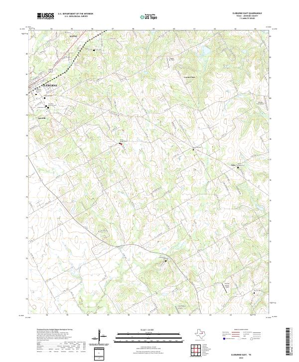
2022 Map of Cleburne East
USGS Topo · Published 2022About this map
The eastern edges of Cleburne and Keene anchor this Johnson County landscape, where urban grid-work gives way to the drainage systems of the Chambers Creek forks. This region is notable for its dense concentration of rural burial sites, including Midway Cem and Faulkenbury Cem, reflecting generations of family settlement. The topography is defined by the branching tributaries of Mustang Cr and the Middle Fork S Fork Chambers Cr, which create a rolling patchwork of creek bottoms and small plateaus. Aviation history is quietly preserved through several private airstrips like Hodges Air Field and the playfully named Cow Pasture Airport. These small airfields, alongside the tiny settlement of Cuba, reveal a post-war rural Texas character that balances small-town growth with agricultural persistence.
Find a feature on this map
113 named features on this map. Tap any name to fly to it.
Don’t see what you’re looking for? This feature index may not catch every label — zoom into the map to look around manually.
Map Details
Editions of this 2022 Cleburne East Map
This is the sole edition of this map. No revisions or reprints were ever made.
Other maps of this area

1891 · Cleburne
USGS Topo · 1:125,000

1894 · Cleburne
USGS Topo · 1:125,000

1924 · Cleburne 3-B
USGS Topo · 1:48,000

1927 · Blum
USGS Topo · 1:62,500

1954 · Dallas
USGS Topo · 1:250,000

1958 · Dallas
USGS Topo · 1:250,000

1960 · Keene
USGS Topo · 1:24,000

1960 · Cleburne East
USGS Topo · 1:24,000
1961 · Cleburne West
USGS Topo · 1:24,000

1961 · Alvarado
USGS Topo · 1:24,000