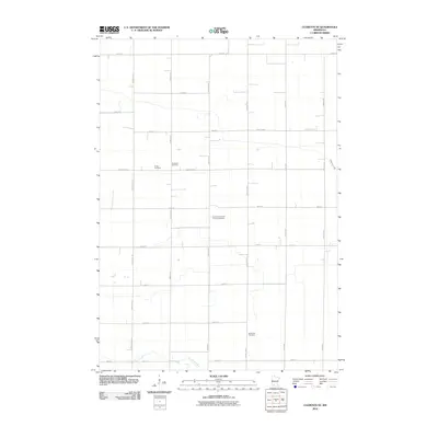
2010 Map of Clements SE
USGS Topo · Published 2010About this map
The agricultural landscape of Brown County is defined by a precise section-line grid of rural roads and scattered family burial grounds. Waterways such as Sleepy Eye Creek and Coal Mine Creek cut across this geometric layout, providing natural breaks in the vast expanses of farmland. The distribution of cemeteries, including the Sundown Lutheran Church Cemetery and North Star Cemetery, points to the long-standing community centers and early congregations that settled this prairie region. Located between County Hwy-4 and County Hwy-2, these sites offer researchers a way to trace the footprints of German and Scandinavian immigrant families. The network of local routes like Magnolia Ave and Nature Ave connects the homesteads that have maintained the rural character of this southern Minnesota township through the turn of the twenty-first century.
Find a feature on this map
26 named features on this map. Tap any name to fly to it.
Don’t see what you’re looking for? This feature index may not catch every label — zoom into the map to look around manually.
Map Details
Editions of this 2010 Clements SE Map
This is the sole edition of this map. No revisions or reprints were ever made.
Other maps of this area

1953 · Morgan
USGS Topo · 1:62,500

1953 · New Ulm
USGS Topo · 1:250,000

1957 · New Ulm
USGS Topo · 1:250,000

1958 · New Ulm
USGS Topo · 1:250,000

1967 · New Ulm
USGS Topo · 1:250,000

1967 · Wanda
USGS Topo · 1:24,000

1967 · Sanborn
USGS Topo · 1:24,000

1967 · Clements
USGS Topo · 1:24,000

1967 · Clements SE
USGS Topo · 1:24,000

1967 · Rowena
USGS Topo · 1:24,000