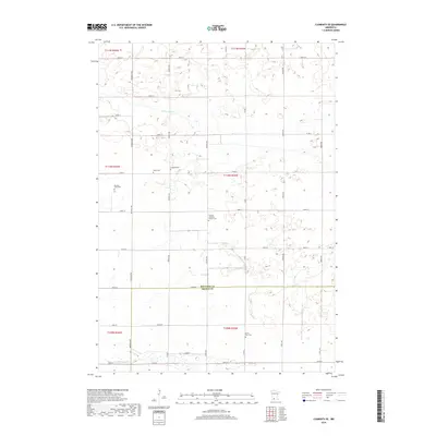
2019 Map of Clements SE
USGS Topo · Published 2019About this map
Sleepy Eye Creek and Coal Mine Creek meander across this agricultural landscape along the border of Redwood and Brown counties. The area is defined by a strict grid of section roads including Magnolia Avenue and Nature Avenue, which connect several legacy burial sites that reflect the region's pioneer genealogy. Of particular interest to family historians are the Missouri Evans Plot, Tonak Cemetery, and Sundown Lutheran Church Cemetery. The topography is relatively flat with subtle drainage patterns flowing toward the creeks, while larger landmarks like the North Star Cemetery near the southern edge provide fixed points for locating ancestral farmsteads. This survey documents the persistent rural character of these townships where watercourses like Coal Mine Creek still dictate the breaks in the geometric survey lines.
Find a feature on this map
36 named features on this map. Tap any name to fly to it.
Don’t see what you’re looking for? This feature index may not catch every label — zoom into the map to look around manually.
Map Details
Editions of this 2019 Clements SE Map
This is the sole edition of this map. No revisions or reprints were ever made.
Other maps of this area

1953 · Morgan
USGS Topo · 1:62,500

1953 · New Ulm
USGS Topo · 1:250,000

1957 · New Ulm
USGS Topo · 1:250,000

1958 · New Ulm
USGS Topo · 1:250,000

1967 · New Ulm
USGS Topo · 1:250,000

1967 · Wanda
USGS Topo · 1:24,000

1967 · Sanborn
USGS Topo · 1:24,000

1967 · Clements
USGS Topo · 1:24,000

1967 · Clements SE
USGS Topo · 1:24,000

1967 · Rowena
USGS Topo · 1:24,000