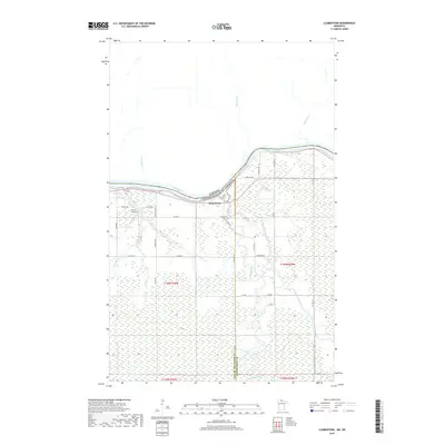
2019 Map of Clementson
USGS Topo · Published 2019About this map
Rainy River defines the international border on this northern Minnesota frontier, where the settlement of Clementson sits at the confluence of several vital waterways. The landscape is characterized by its complex drainage network, with the Rapid River and its East Fork winding through the eastern portion of the quadrangle. Near the center, Eidens Rapids marks a distinct point in the river's descent. To the west, the Silver Creek Cem serves as a local landmark for genealogists, situated near Silver Cr and W Br Silver Cr. The area is bisected by the border between Lake of the Woods and Koochiching counties, showing a rural infrastructure of township roads such as Town Rd 389 and Co Hwy 19 that connect isolated properties and wetlands across this heavily glaciated terrain.
Find a feature on this map
30 named features on this map. Tap any name to fly to it.
Don’t see what you’re looking for? This feature index may not catch every label — zoom into the map to look around manually.
Map Details
Editions of this 2019 Clementson Map
This is the sole edition of this map. No revisions or reprints were ever made.
Other maps of this area

1919 · Canada
USGS Topo · 1:62,500

1921 · Baudette
USGS Topo · 1:62,500

1954 · Roseau
USGS Topo · 1:250,000

1957 · Roseau
USGS Topo · 1:250,000

1958 · Roseau
USGS Topo · 1:250,000

1968 · Baudette SE
USGS Topo · 1:24,000

1968 · Clementson
USGS Topo · 1:24,000

1968 · Border
USGS Topo · 1:24,000

1968 · Clementson SW
USGS Topo · 1:24,000

1968 · Clementson SE
USGS Topo · 1:24,000