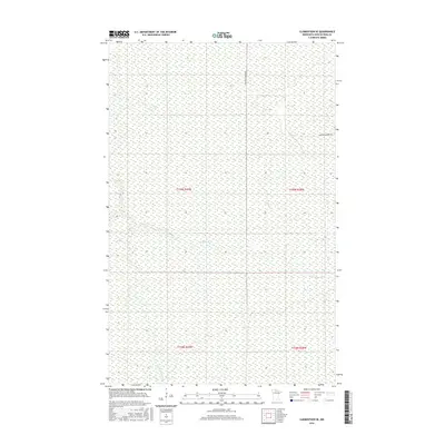
2016 Map of Clementson SE
USGS Topo · Published 2016About this map
Wing River meanders across this northern Minnesota landscape, where the flat, water-logged terrain of Koochiching County is defined by extensive wetlands and seasonal drainages. In this remote section of the North Woods, the Fork Rapid River flows through the southwestern corner, illustrating the complex hydrological network that feeds the larger regional basins. The map captures the quiet transition of land use in the 21st century, where human footprint is minimal and limited primarily to peripheral infrastructure. One of the few markers of passage through this territory is Frontier Farmers Rd, which skirts the northern boundary, providing a rare point of access for those managing the surrounding timber and bog lands.
Find a feature on this map
7 named features on this map. Tap any name to fly to it.
Don’t see what you’re looking for? This feature index may not catch every label — zoom into the map to look around manually.
Map Details
Editions of this 2016 Clementson SE Map
This is the sole edition of this map. No revisions or reprints were ever made.
Other maps of this area

1919 · Birchdale
USGS Topo · 1:62,500

1919 · I
USGS Topo · 1:62,500

1954 · Roseau
USGS Topo · 1:250,000

1957 · Roseau
USGS Topo · 1:250,000

1958 · Roseau
USGS Topo · 1:250,000

1968 · Clementson
USGS Topo · 1:24,000

1968 · Birchdale SW
USGS Topo · 1:24,000

1968 · Stratton
USGS Topo · 1:24,000

1968 · Border
USGS Topo · 1:24,000

1968 · Clementson SW
USGS Topo · 1:24,000