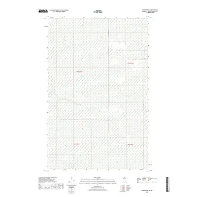
2019 Map of Clementson SE
USGS Topo · Published 2019About this map
Wing River meanders through this heavily wetland-dominated landscape in northern Koochiching County, showing a wilderness area defined by complex hydrology rather than dense settlement. The geography is characterized by extensive marshlands and peatlands, with subtle drainage patterns formed by Bartons Brook and the Fork Wing River. These waterways reveal the natural transition of the Minnesota backcountry as it appeared in the early 21st century. Human presence is sparse, confined primarily to the far eastern edge where Frontier Farmers Rd provides limited access into the interior. The survey provides a clear look at the township and range boundaries, specifically where t159n r29w meets t159n r28w, illustrating the geometric grid of the Public Land Survey System laid over the organic, shifting boundaries of the regional river systems.
Find a feature on this map
8 named features on this map. Tap any name to fly to it.
Don’t see what you’re looking for? This feature index may not catch every label — zoom into the map to look around manually.
Map Details
Editions of this 2019 Clementson SE Map
This is the sole edition of this map. No revisions or reprints were ever made.
Other maps of this area

1919 · Birchdale
USGS Topo · 1:62,500

1919 · I
USGS Topo · 1:62,500

1954 · Roseau
USGS Topo · 1:250,000

1957 · Roseau
USGS Topo · 1:250,000

1958 · Roseau
USGS Topo · 1:250,000

1968 · Clementson
USGS Topo · 1:24,000

1968 · Birchdale SW
USGS Topo · 1:24,000

1968 · Stratton
USGS Topo · 1:24,000

1968 · Border
USGS Topo · 1:24,000

1968 · Clementson SW
USGS Topo · 1:24,000