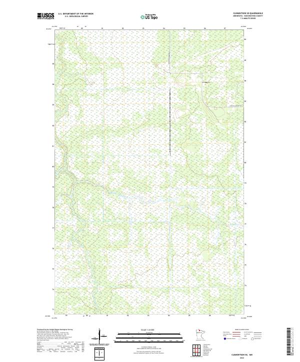
2022 Map of Clementson SE
USGS Topo · Published 2022About this map
Wing River meanders across this northern Minnesota landscape, defining a wetland-heavy terrain that characterizes the southeastern portion of the Clementson area. In this remote section of Koochiching County, the hydrology is dominated by the slow-moving river and the tributary Barrows Brook, which drains into the surrounding marshes. Human intervention in this environment is sparse, centered primarily on the corridor of Frontier Farmers Rd in the northeastern quadrant. The map detail reflects the persistence of the Public Land Survey System, with the boundaries of t159n r29w, t159n r28w, t158n r29w, and t158n r28w providing the primary structure for this largely undeveloped wilderness.
Find a feature on this map
7 named features on this map. Tap any name to fly to it.
Don’t see what you’re looking for? This feature index may not catch every label — zoom into the map to look around manually.
Map Details
Editions of this 2022 Clementson SE Map
This is the sole edition of this map. No revisions or reprints were ever made.
Other maps of this area

1919 · Birchdale
USGS Topo · 1:62,500

1919 · I
USGS Topo · 1:62,500

1954 · Roseau
USGS Topo · 1:250,000

1957 · Roseau
USGS Topo · 1:250,000

1958 · Roseau
USGS Topo · 1:250,000

1968 · Clementson
USGS Topo · 1:24,000

1968 · Birchdale SW
USGS Topo · 1:24,000

1968 · Stratton
USGS Topo · 1:24,000

1968 · Border
USGS Topo · 1:24,000

1968 · Clementson SW
USGS Topo · 1:24,000