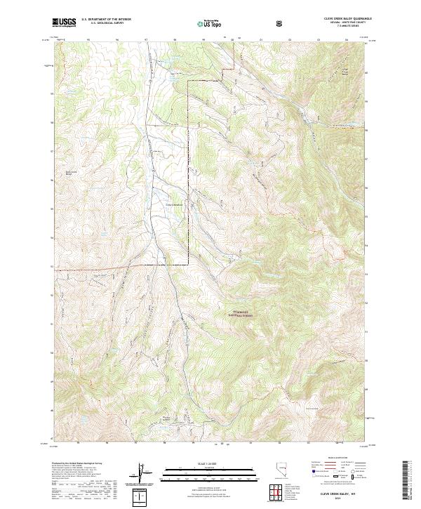
2021 Map of Cleve Creek Baldy
USGS Topo · Published 2021About this map
Humboldt National Forest encompasses much of this terrain in White Pine County, where high-elevation drainage systems define the landscape. Between the Duck Creek Range and the Schell Creek Range, the map details a complex network of canyons and meadows. Industrial history is noted at the Brenhen Mine II near Wellington Springs, while the hydrological importance of the area is evident in numerous named water sources like Axehandle Spring, McGill Spring, and Peacock Spring. The eastern slopes of the Schell Creek Range are marked by deep incisions such as Ostergard Canyon and Doe Canyon. To the south, high-altitude features including Cleve Creek Baldy and Success Summit overlook French Lake, with various forest trails like the Cleve Creek Baldy Trl providing access through these remote reaches of Nevada.
Find a feature on this map
44 named features on this map. Tap any name to fly to it.
Don’t see what you’re looking for? This feature index may not catch every label — zoom into the map to look around manually.
Map Details
Editions of this 2021 Cleve Creek Baldy Map
This is the sole edition of this map. No revisions or reprints were ever made.
Other maps of this area

1952 · Ely
USGS Topo · 1:125,000

1956 · Ely
USGS Topo · 1:250,000

1958 · McGill
USGS Topo · 1:24,000

1958 · East Ely
USGS Topo · 1:24,000

1958 · Comins Lake
USGS Topo · 1:24,000

1958 · Ely
USGS Topo · 1:62,500

1958 · McGill
USGS Topo · 1:62,500

1959 · Ely
USGS Topo · 1:250,000

1959 · Connors Pass
USGS Topo · 1:62,500

1959 · Schell Peaks
USGS Topo · 1:62,500