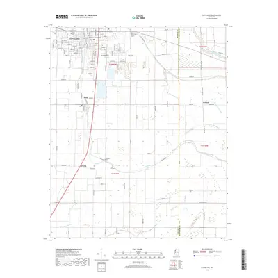
2018 Map of Cleveland
USGS Topo · Published 2018About this map
Cleveland stands as the primary hub of this Mississippi Delta landscape, home to the campus of Delta State Univ and a dense network of residential streets such as Maple St and Harvard St. The town's infrastructure is highlighted by the South Court Street Bridge crossing Pecan Bayou, a waterway that snakes through the city center. Outside the city limits, the terrain transitions into a strictly surveyed grid of agricultural land and managed drainage, with the Big Sunflower River and Lead Bayou defining the eastern reaches.
Find a feature on this map
82 named features on this map. Tap any name to fly to it.
Don’t see what you’re looking for? This feature index may not catch every label — zoom into the map to look around manually.
Map Details
Editions of this 2018 Cleveland Map
This is the sole edition of this map. No revisions or reprints were ever made.
Other maps of this area

1931 · Drew
USGS Topo · 1:48,000

1934 · Cleveland
USGS Topo · 1:62,500

1935 · Mound Bayou
USGS Topo · 1:62,500

1939 · Pace
USGS Topo · 1:62,500

1939 · Choctaw
USGS Topo · 1:62,500

1940 · Cleveland
USGS Topo · 1:62,500

1953 · Greenwood
USGS Topo · 1:250,000

1956 · Greenwood
USGS Topo · 1:250,000
1966 · Merigold
USGS Topo · 1:24,000

1966 · Cleveland
USGS Topo · 1:24,000