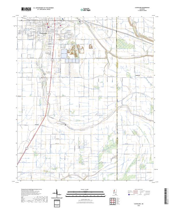
2024 Map of Cleveland
USGS Topo · Published 2024About this map
Cleveland serves as the focal point of this Mississippi Delta survey, anchored by the Bolivar County Courthouse and the extensive campus of Delta State University. The town's grid is bisected by the S Illinois Central Ave corridor, reflecting the deep rail history of the region. Moving south from the city center, the landscape transitions into a network of drainage channels and bayous, including Jones Bayou and Pecan Bayou, which define the agricultural character of the surrounding Bolivar County countryside. Small settlements like Boyle and O'Reilly dot the landscape, connected by a structured grid of rural roads such as W Sunflower Rd and Peavine Rd. Local heritage is preserved in several burial grounds, notably Chrisman Cem, Fairview Cem, and the Poplar Grove Methodist Church Cem, which provide specific points of interest for genealogists tracing family roots in this fertile alluvial plain.
Find a feature on this map
54 named features on this map. Tap any name to fly to it.
Don’t see what you’re looking for? This feature index may not catch every label — zoom into the map to look around manually.
Map Details
Editions of this 2024 Cleveland Map
This is the sole edition of this map. No revisions or reprints were ever made.
Other maps of this area

1931 · Drew
USGS Topo · 1:48,000

1934 · Cleveland
USGS Topo · 1:62,500

1935 · Mound Bayou
USGS Topo · 1:62,500

1939 · Pace
USGS Topo · 1:62,500

1939 · Choctaw
USGS Topo · 1:62,500

1940 · Cleveland
USGS Topo · 1:62,500

1953 · Greenwood
USGS Topo · 1:250,000

1956 · Greenwood
USGS Topo · 1:250,000
1966 · Merigold
USGS Topo · 1:24,000

1966 · Cleveland
USGS Topo · 1:24,000