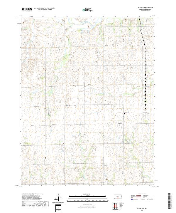
2022 Map of Cleveland
USGS Topo · Published 2022About this map
The South Fork Ninnescah River cuts across the northern edge of this Kingman County landscape, defining the local drainage system as it flows eastward. This rural Kansas region is marked by a network of creek beds including Wild-Horse Cr, Hunter Cr, and Wild Run Cr, which carve into the terrain south of the river. The area's genealogical and social history is anchored by the Cleveland Cem, located just north of Cleveland Rd. The section lines are strictly maintained by a grid of rural routes such as Ball Park Rd and numbered avenues, illustrating the enduring township and range system of the American Midwest. This 2022 survey provides a modern view of the agricultural patterns and watercourses that have shaped this area since the early days of Kingman County's settlement.
Find a feature on this map
31 named features on this map. Tap any name to fly to it.
Don’t see what you’re looking for? This feature index may not catch every label — zoom into the map to look around manually.
Map Details
Editions of this 2022 Cleveland Map
This is the sole edition of this map. No revisions or reprints were ever made.
Other maps of this area

1889 · Anthony
USGS Topo · 1:125,000

1891 · Anthony
USGS Topo · 1:125,000

1892 · Kingman
USGS Topo · 1:125,000

1894 · Kingman
USGS Topo · 1:125,000

1955 · Pratt
USGS Topo · 1:250,000

1959 · Pratt
USGS Topo · 1:250,000

1967 · Kingman NW
USGS Topo · 1:24,000
1967 · Alameda
USGS Topo · 1:24,000

1967 · Cleveland
USGS Topo · 1:24,000
1967 · Kingman
USGS Topo · 1:24,000