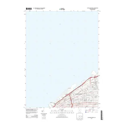
2013 Map of Cleveland North
USGS Topo · Published 2013About this map
Lake Erie defines the northern edge of this urban landscape, where the waterfront is heavily developed for transportation and recreation. The shoreline features the Burke Lakefront Airport and the Cleveland Browns Stadium, marking the city's modern infrastructure and public spaces. Further inland, the dense street grid of Cleveland is visible, including major thoroughfares like Euclid Ave and Saint Clair Ave NE. Educational institutions such as Cleveland State Univ and Chancellor Univ are integrated into the city's layout, reflecting its role as a regional center for higher learning.
Find a feature on this map
87 named features on this map. Tap any name to fly to it.
Don’t see what you’re looking for? This feature index may not catch every label — zoom into the map to look around manually.
Map Details
Editions of this 2013 Cleveland North Map
This is the sole edition of this map. No revisions or reprints were ever made.
Other maps of this area

1901 · Euclid
USGS Topo · 1:62,500

1902 · Berea
USGS Topo · 1:62,500

1903 · Cleveland
USGS Topo · 1:62,500

1903 · Euclid
USGS Topo · 1:62,500

1904 · Berea
USGS Topo · 1:62,500

1950 · Cleveland
USGS Topo · 1:250,000

1953 · Shaker Heights
USGS Topo · 1:24,000

1953 · East Cleveland
USGS Topo · 1:24,000
1953 · Cleveland South
USGS Topo · 1:24,000
1953 · Lakewood
USGS Topo · 1:24,000