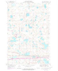
1954 Map of Cleveland NW
USGS Topo · Published 1978About this map
The town of Cleveland anchors the southeastern corner of this Stutsman County landscape, situated at a critical rail intersection. The area is defined by its complex wetland systems, most notably the Runner Slough that stretches across the southern sections. This map documents a period of transition for the region's transportation infrastructure, showing the Burlington Northern line passing through the town and the Chicago and North Western corridor further south.
Find a feature on this map
12 named features on this map. Tap any name to fly to it.
Don’t see what you’re looking for? This feature index may not catch every label — zoom into the map to look around manually.
Map Details
Editions of this 1954 Cleveland NW Map
2 editions found
Other maps of this area

1952 · New Rockford
USGS Topo · 1:250,000

1953 · Jamestown
USGS Topo · 1:250,000

1953 · Cleveland SE
USGS Topo · 1:24,000

1953 · Cleveland
USGS Topo · 1:24,000

1953 · Cleveland SW
USGS Topo · 1:24,000

1954 · Cleveland NW
USGS Topo · 1:24,000

1954 · Medina
USGS Topo · 1:24,000

1955 · Medina SE
USGS Topo · 1:24,000

1956 · New Rockford
USGS Topo · 1:250,000

1956 · Jamestown
USGS Topo · 1:250,000