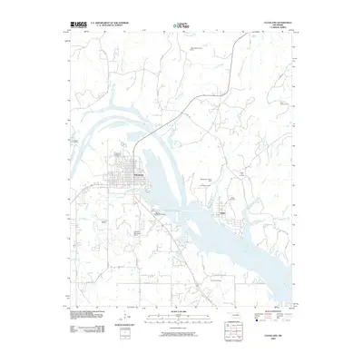
2009 Map of Cleveland
USGS Topo · Published 2009About this map
The Arkansas River carves a wide path through this landscape, separating the town of Cleveland in the west from the smaller settlement of Osage in the east. This 2009 survey highlights a region deeply defined by the energy industry, with several significant petroleum operations including the Boston Oil Field, Cleveland Oil Field, and Osage City Oil Field dotting the terrain. The presence of these fields alongside the river and its tributaries, such as Mechetsemoi Creek and Scanlon Creek, suggests a long history of industrial activity integrated into the river valley. Local heritage is preserved in numerous burial grounds, including Woodland Cemetery and the Bear Creek Cemetery, which serve as vital landmarks for genealogists. To the south of the main settlement, the Cleveland Municipal Airport and infrastructure like the Oknoname 113100 Dam reflect the modern development of this Pawnee County river corridor.
Find a feature on this map
45 named features on this map. Tap any name to fly to it.
Don’t see what you’re looking for? This feature index may not catch every label — zoom into the map to look around manually.
Map Details
Editions of this 2009 Cleveland Map
This is the sole edition of this map. No revisions or reprints were ever made.
Other maps of this area

1912 · Hominy
USGS Topo · 1:125,000

1915 · Hominy
USGS Topo · 1:125,000

1915 · Hominy
USGS Topo · 1:62,500

1929 · Yale
USGS Topo · 1:62,500

1929 · Skedee
USGS Topo · 1:62,500

1931 · Skedee
USGS Topo · 1:62,500

1932 · Yale
USGS Topo · 1:62,500

1955 · Enid
USGS Topo · 1:250,000

1958 · Enid
USGS Topo · 1:250,000

1958 · Keystone Dam
USGS Topo · 1:24,000