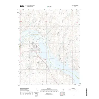
2018 Map of Cleveland
USGS Topo · Published 2018About this map
Keystone Lake dominates the southern landscape of this Oklahoma region, where the Arkansas River flows through the border of Osage and Pawnee counties. The town of Cleveland serves as the primary hub, showing a detailed street grid including W Pawnee St and W Cherokee St. To the east, the smaller settlement of Osage sits near the northern reaches of the reservoir. The topography is defined by the drainage systems of Scanlon Creek and Cedar Cr, alongside prominent elevations like Big Hill. For those tracing local history, several established burial grounds are marked across the area, including Woodland Cem just north of Cleveland and the pair of Dixie Cem and Bear Creek Cem located further south near the Cleveland Municipal Airport.
Find a feature on this map
88 named features on this map. Tap any name to fly to it.
Don’t see what you’re looking for? This feature index may not catch every label — zoom into the map to look around manually.
Map Details
Editions of this 2018 Cleveland Map
This is the sole edition of this map. No revisions or reprints were ever made.
Other maps of this area

1912 · Hominy
USGS Topo · 1:125,000

1915 · Hominy
USGS Topo · 1:125,000

1915 · Hominy
USGS Topo · 1:62,500

1929 · Yale
USGS Topo · 1:62,500

1929 · Skedee
USGS Topo · 1:62,500

1931 · Skedee
USGS Topo · 1:62,500

1932 · Yale
USGS Topo · 1:62,500

1955 · Enid
USGS Topo · 1:250,000

1958 · Enid
USGS Topo · 1:250,000

1958 · Keystone Dam
USGS Topo · 1:24,000