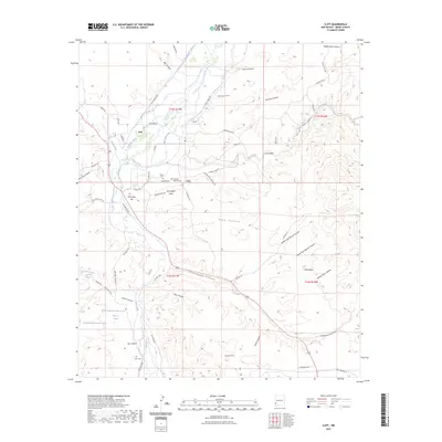
2023 Map of Cliff
USGS Topo · Published 2023About this map
Cliff and Gila serve as the primary human settlements in this arid New Mexico landscape, situated where the Gila River meets the tributary waters of Duck Creek and Bear Creek. The geography here is defined by an intricate network of man-made irrigation channels, such as the Upper Gila Ditch, Gila Farm Ditch, and Riverside Ditch, which redirect water from the river to the narrow, fertile valley floors. This dependence on water management is a hallmark of the region's agricultural history, allowing for life to thrive beneath the surrounding high ground of Graveyard Mesa and Mesa. For those researching local history, the map provides precise locations for the Mesa Cem, Cliff Gila Catholic Cem, and the more isolated Clark Cem to the south. Prominent terrain features like Fort West Hill and Table Butte offer clear landmarks against the deeply eroded drainage systems of Greenwood Canyon and Pope Canyon.
Find a feature on this map
78 named features on this map. Tap any name to fly to it.
Don’t see what you’re looking for? This feature index may not catch every label — zoom into the map to look around manually.
Map Details
Editions of this 2023 Cliff Map
This is the sole edition of this map. No revisions or reprints were ever made.
Other maps of this area

1909 · Silver City
USGS Topo · 1:125,000

1910 · Mogollon
USGS Topo · 1:125,000

1911 · Alum Mountain
USGS Topo · 1:125,000

1912 · Mogollon
USGS Topo · 1:125,000

1913 · Alum Mountain
USGS Topo · 1:125,000

1949 · Circle Mesa
USGS Topo · 1:24,000

1950 · Dorsey Ranch
USGS Topo · 1:24,000

1951 · Circle Mesa
USGS Topo · 1:24,000

1951 · Dorsey Ranch
USGS Topo · 1:24,000

1954 · Silver City
USGS Topo · 1:250,000