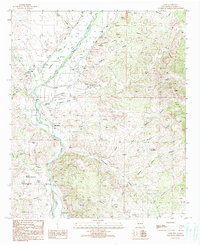
1990 Map of Cliff
USGS Topo · Published 1991About this map
The Gila River corridor serves as the primary artery for settlement and agriculture in this southwestern New Mexico landscape, anchoring the communities of Cliff, Gila, and Riverside. The river's influence is evident in the intricate network of levees, ditches, and wells that support local holdings like Farm and Mc Millen. This water-dependent economy is bounded by the dramatic rise of Graveyard Mesa and the complex drainage systems of Duck Creek and Bear Creek.
Find a feature on this map
44 named features on this map. Tap any name to fly to it.
Don’t see what you’re looking for? This feature index may not catch every label — zoom into the map to look around manually.
Map Details
Editions of this 1990 Cliff Map
This is the sole edition of this map. No revisions or reprints were ever made.
Other maps of this area

1909 · Silver City
USGS Topo · 1:125,000

1910 · Mogollon
USGS Topo · 1:125,000

1911 · Alum Mountain
USGS Topo · 1:125,000

1912 · Mogollon
USGS Topo · 1:125,000

1913 · Alum Mountain
USGS Topo · 1:125,000

1949 · Circle Mesa
USGS Topo · 1:24,000

1950 · Dorsey Ranch
USGS Topo · 1:24,000

1951 · Circle Mesa
USGS Topo · 1:24,000

1951 · Dorsey Ranch
USGS Topo · 1:24,000

1954 · Silver City
USGS Topo · 1:250,000