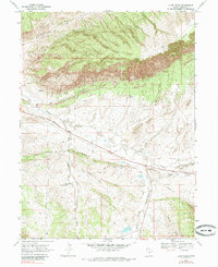
1968 Map of Cliff Ridge
USGS Topo · Published 1985About this map
Cliff Ridge dominates this 1960s landscape in Uintah County, where the high desert terrain is defined by dramatic geological formations and remote industrial activity. The prominent escarpment of The Rimrock cuts across the center of the sheet, dividing the high plateau from the lower drainages. This era of land use is clearly visible through the presence of several Drill Holes and a Pipeline that traverses the central basin, alongside scattered resource extraction points like the Gravel Pit near Birch Creek.
Find a feature on this map
32 named features on this map. Tap any name to fly to it.
Don’t see what you’re looking for? This feature index may not catch every label — zoom into the map to look around manually.
Map Details
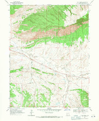
Editions of this 1968 Cliff Ridge Map
2 editions found
Other maps of this area

1885 · Ashley
USGS Topo · 1:250,000

1907 · Jensen
USGS Topo · 1:125,000

1910 · Jensen
USGS Topo · 1:125,000

1954 · Vernal
USGS Topo · 1:250,000

1955 · Stuntz Reservoir
USGS Topo · 1:24,000

1955 · Split Mountain
USGS Topo · 1:24,000

1958 · Vernal
USGS Topo · 1:250,000

1960 · Vernal
USGS Topo · 1:250,000
1965 · Dinosaur Quarry
USGS Topo · 1:24,000
1965 · Jensen
USGS Topo · 1:24,000